
NPSO 2019 Annual Meeting
July 12-14 Klamath-Siskiyou Mountains
Field Trips
Saturday July 13, 2019 8:15 - 4:30 Field Trip # 24
Grayback Mountain and Big Sugarloaf Peak
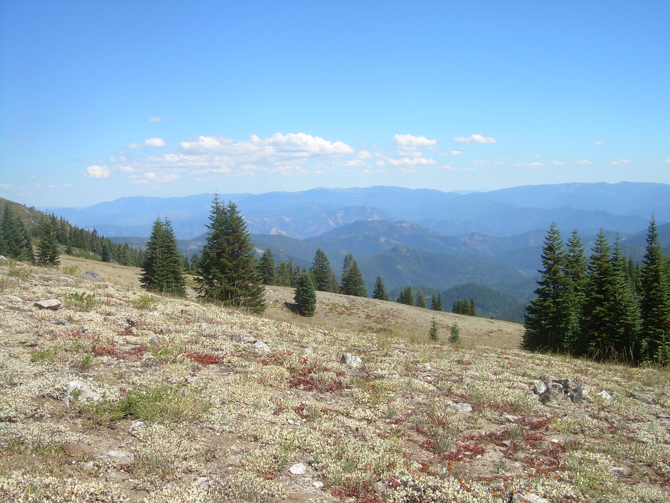
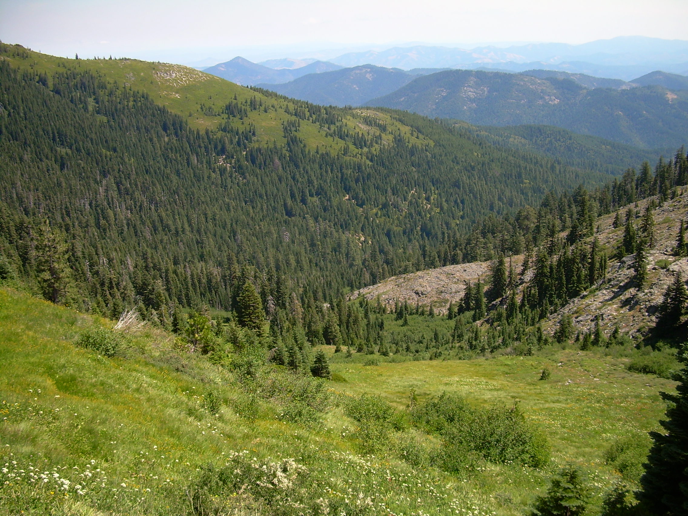 Wet meadows and views on Grayback Mountain
Difficulty: Difficult (5 miles round trip) - 2200 ft. elevation gain, some off-trail hiking, some wet areas, some talus
Elevation: 4600 ft. to 6800 ft. (2200 ft. of elevation gain)
Group Size Limit: 15
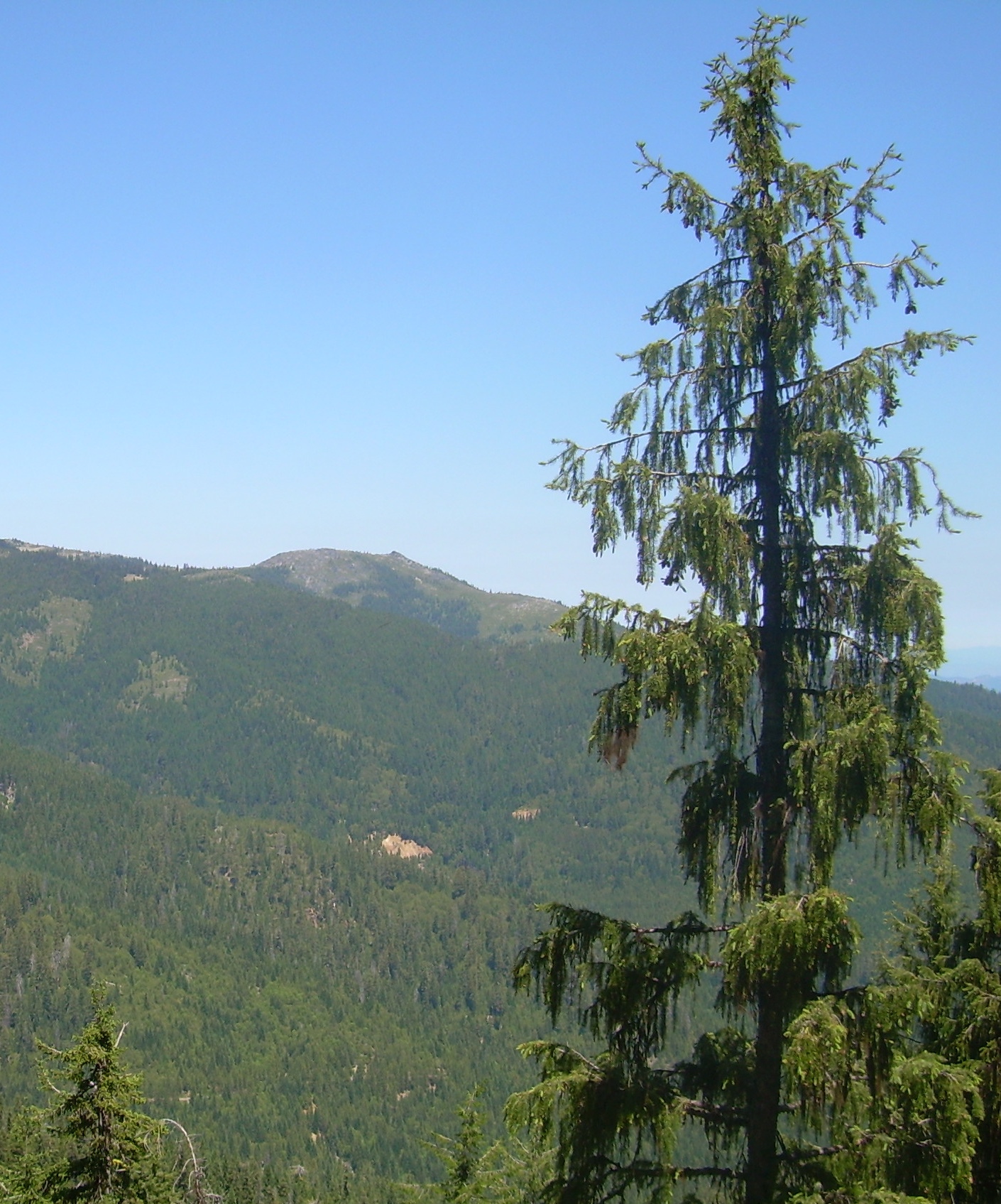 Brewer's spruce - Picea breweriana
Trip Description: An ambitious but great summer wildflower hike. Grayback and Big Sugarloaf are granitic high points in the "Boundary Range" dividing the Applegate and Illinois River watersheds, south of Williams, OR (and Pacifica).
We will drive via Thompson Creek Road, hike up the O'Brien Creek Trail, and also use the north end of the Boundary Trail. The trail climbs through conifer forest to 5500 ft. Then we divert off-trail to the long open hillslope wetland above the former Krause Cabin as well as rock outcrops in that vicinity. We will climb above the Boundary Trail, ending up high on Grayback Mountain (but skipping the bouldery summit). Then we will descend to walk the Boundary Trail northward 1 mile to Big Sugarloaf Peak and dry open slopes and ridges in that vicinity. Our return will be cross-country downhill to rejoin the O'Brien Creek Trail at 5500 ft. and then back down to the trailhead.
In addition to the special status species listed below, we will see the Klamath Mountains endemics Ribes marshallii, Lilium wigginsii, and perhaps Brewer's spruce. Also present are a number of taxa which are rare or uncommon in SW Oregon but more common elsewhere in Oregon. Besides the gentians in the wetland (unlikely to be blooming on this date) the upper east slope of Grayback Mountain has the largest population of Anemone occidentalis in the Siskiyou Mountains.
Floristic Highlights: Gentiana pleurisetosa (ORBIC list 1), Lewisia leeana (ORBIC list 2), Hierochloe odorata (ORBIC list 4), Eriogonum diclinum (ORBIC list 4), Hazardia whitneyi var. discoidea (ORBIC list 4). Also see trip description.
Appropriate Footwear: Hiking boots
Special Considerations: Bring trekking poles if you use them.
Meeting Place and Time: Trip # 24 leaves at 8:15 from Pacifica.
Alternate Meeting:
To accomodate trip members who aren't staying at Pacifica, this trip will also pick up members at its first stop at The Applegate Store at 8:30am, (15095 Hwy 238, Applegate OR).
Driving Directions: From Pacifica drive north on Water Gap Road and turn right (east) onto Highway 238. Go 6.3 miles to the Applegate Store, which is on the right just after you cross the green bridge over the river. After our meet-up and carpooling there, we re-cross the bridge then turn immediately left on Thompson Creek Road. After 11.9 miles the pavement ends at a four-way intersection. Turn right onto Forest Service Road 1005 and drive four miles to the O'Brien Creek Trailhead.
Driving miles from Pacifica to trailhead: 15 miles and 45 minutes one-way from Applegate Store
Leader: Wayne Rolle
Wayne Rolle, retired Rogue River-Siskiyou National Forest botanist and longtime NPSO member, has been exploring the Southwest Oregon and Northwest California flora for over 40 years. He's looking forward to sharing a favorite destination with other native plant enthusiasts.
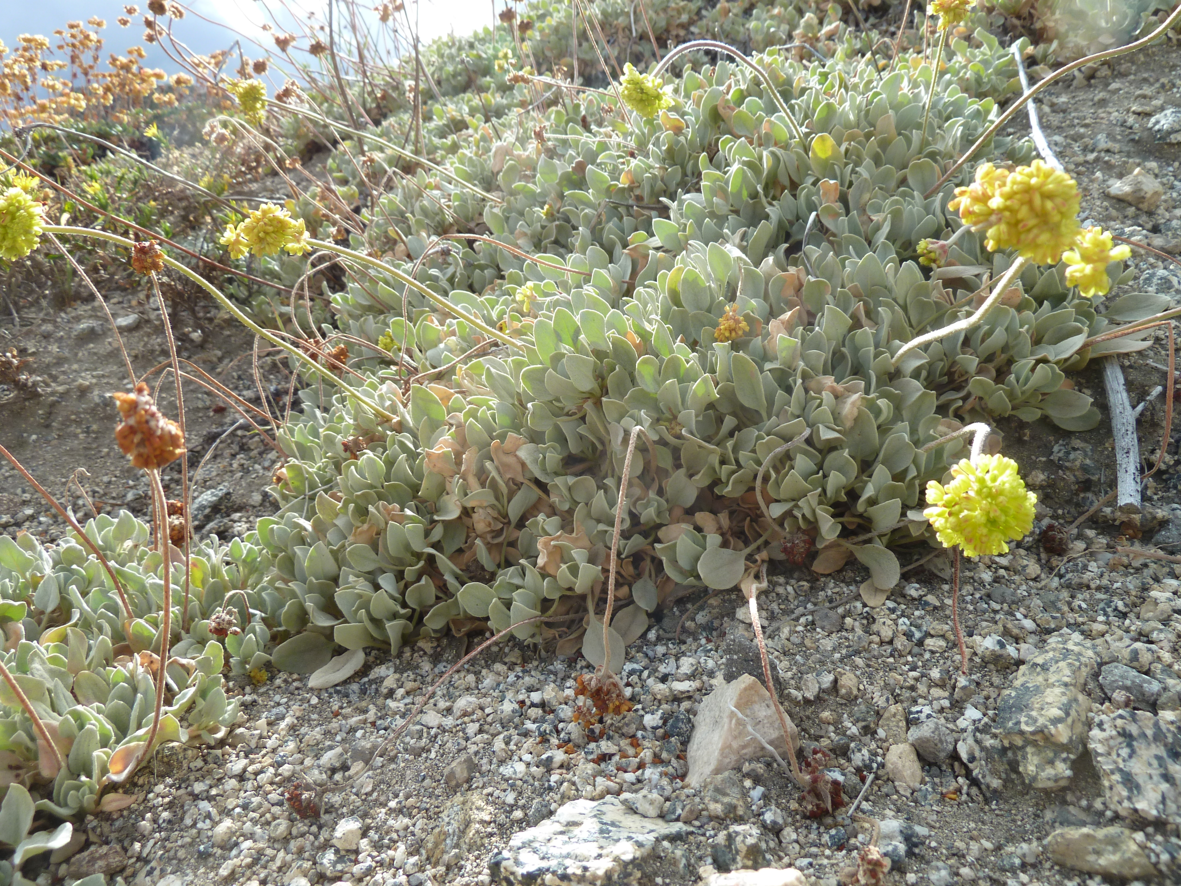 Jayne's canyon buckwheat - Eriogonum diclinum
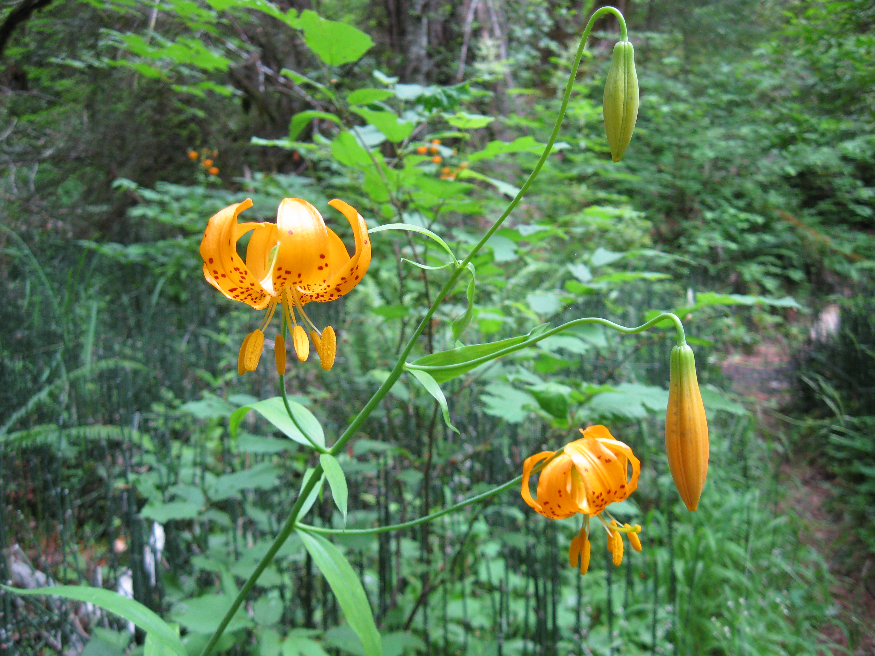 Wiggins' lily - Lilium pardalinum ssp. wigginsii
 Dry meadows near Grayback Mountain
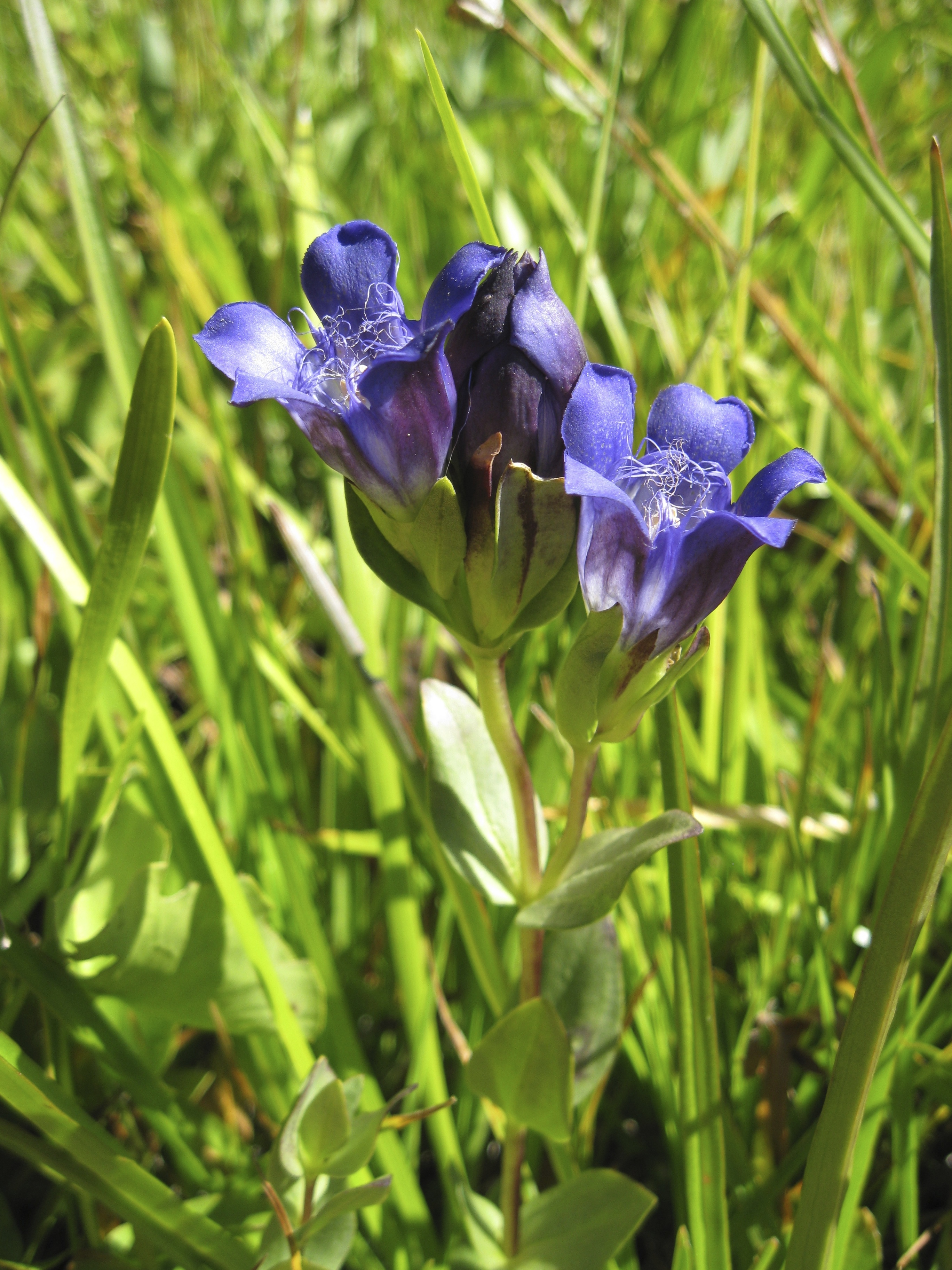 Bristly gentian - Gentiana pluresitosa
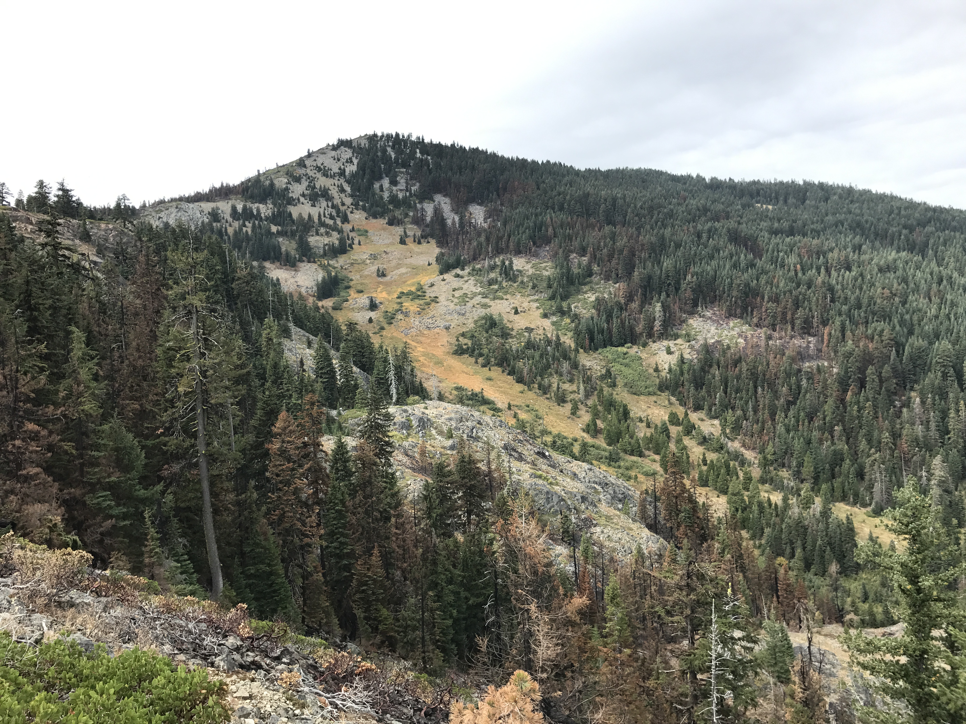 Grayback Mountain, fall 2017, after low-severity fire effects from the Creedence Fire.

©2019 Siskiyou Chapter, NPSO